


KC WD1 PCT511, Jackson County, Missouri
About
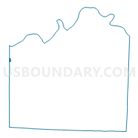
Outline

Summary
| Unique Area Identifier | 608285 |
| Name | KC WD1 PCT511 |
| County | Jackson County |
| State | Missouri |
| Area (square miles) | 0.18 |
| Land Area (square miles) | 0.18 |
| Water Area (square miles) | 0.00 |
| % of Land Area | 100.00 |
| % of Water Area | 0.00 |
| Latitude of the Internal Point | 39.06555040 |
| Longtitude of the Internal Point | -94.60495480 |
Maps


Graphs
Select a template below for downloading or customizing gragh for KC WD1 PCT511, Jackson County, Missouri


Neighbors
Neighoring Voting District (by Name) Neighboring Voting District on the Map
- Kansas City Ward 8 Precinct 01, Wyandotte County, KS
- KC WD1 PCT108, Jackson County, MO
- KC WD1 PCT109, Jackson County, MO
- KC WD5 PCT504, Jackson County, MO
Top 10 Neighboring County Subdivision (by Population) Neighboring County Subdivision on the Map
Top 10 Neighboring Place (by Population) Neighboring Place on the Map
Top 10 Neighboring Unified School District (by Population) Neighboring Unified School District on the Map
Top 10 Neighboring State Legislative District Lower Chamber (by Population) Neighboring State Legislative District Lower Chamber on the Map
- State House District 37, MO (33,162)
- State House District 39, MO (32,519)
- State House District 32, KS (20,891)
Top 10 Neighboring State Legislative District Upper Chamber (by Population) Neighboring State Legislative District Upper Chamber on the Map
Top 10 Neighboring 111th Congressional District (by Population) Neighboring 111th Congressional District on the Map
Top 10 Neighboring Census Tract (by Population) Neighboring Census Tract on the Map
- Census Tract 452, Wyandotte County, KS (3,980)
- Census Tract 153, Jackson County, MO (3,149)
- Census Tract 46, Jackson County, MO (2,501)